JULY 28 — In South-east Asia, borders are not just lines — they are living legacies of colonial cartography, shifting sovereignties, and unresolved nation-building.
The latest escalation in the Thai-Cambodian conflict reveals how something as seemingly technical as a map scale can become a powder keg of geopolitical tension. At the centre of this intensifying dispute lies a bitter disagreement: Thailand insists on the use of a 1:50,000 map; Cambodia refuses anything but the 1:200,000 version.
To the untrained eye, these figures may seem inconsequential. But for seasoned observers of regional politics, this divergence underscores a broader battle over historical legitimacy, territorial sovereignty, and competing national narratives.
To understand the friction, we must start with the scales themselves. Thailand’s preferred map, at a scale of 1:50,000, is a product of meticulous cartography developed by its Royal Survey Department with technical input from the United States. It is based on the Mercator projection, which privileges accurate distance and direction — critical for military, civil, and administrative functions.
This map presents a high-resolution portrait of the Thai-Cambodian border: every ridge, river, road, and village finely rendered, leaving little to interpretation.
In contrast, Cambodia clings to a 1:200,000 scale map, originally produced by France during its colonial rule.
This map, though far less detailed — 1 centimetre equating to 2 kilometres — is deeply embedded in Cambodia’s legal and historical identity. Anchored in the Franco-Siamese treaties of 1904 and 1907, the map is not only a symbolic relic but the very foundation of Cambodia’s official border claims.
The International Court of Justice (ICJ) famously drew upon this map when awarding Cambodia control of the Preah Vihear Temple in 1962. While the ICJ did not endorse the map’s precision, its citation in such a landmark case fortified Cambodia’s reliance on it.
At the heart of the controversy is not just scale, but projection. Thailand’s Mercator-based map distorts area but preserves direction and shape — ideal for navigation but problematic for representing equatorial landmasses.
Cambodia’s Sinusoidal projection, meanwhile, preserves area but distorts distances, especially at the edges. These divergent projections cannot be reconciled through simple overlay or conversion. The same stretch of land will appear in different locations depending on the map used.
In areas like the Dangrek Mountains — home to contested temples, scam-infested outposts, and mine-laden terrain — the consequences of such discrepancies are not abstract. They are dangerous.

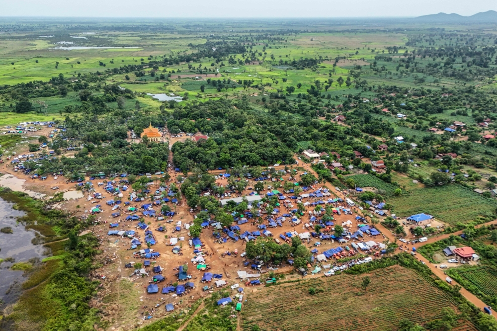
An aerial view shows displaced people seeking shelter near a pagoda in Oddar Meanchey province, after fleeing their homes near the Cambodia-Thailand border July 26, 2025. — AFP pic
Cambodia’s rejection of Thailand’s map stems from both technical incompatibility and principled opposition. Phnom Penh views Thailand’s 1:50,000 map as a unilateral product — one not mutually agreed upon nor recognised in the 2000 Memorandum of Understanding that was supposed to guide border demarcation. By contrast, Cambodia sees its French-produced map as a jointly recognised baseline, affirmed through decades of diplomacy and legal proceedings. Cambodia further argues that Thailand’s insistence on its newer map amounts to an ex post facto revision of territorial claims.
Thailand, for its part, sees the Cambodian map as outdated, imprecise, and ill-suited to modern boundary work. Bangkok contends that the colonial-era map does not meet contemporary geospatial standards and was never intended for granular demarcation. Thai officials assert that sticking to such an antiquated artifact is neither practical nor fair in a world where satellite imagery, GPS, and GIS tools offer pinpoint accuracy. Yet, what may appear fair in technical terms may be perceived as threatening in historical and emotional terms.
Indeed, behind the disagreement over maps lies a deeper asymmetry of perception. For Cambodia, maps are instruments of justice — evidence of colonial wounds and international validation. For Thailand, they are tools of utility — meant to reflect ground realities, not memorialise imperial cartography. When these worldviews collide, diplomacy becomes cartographically constrained, and escalation becomes dangerously probable.
This is not the first time borders drawn on paper have spilled into bloodshed. The 2008 clashes over the Preah Vihear temple led to military confrontations, international mediation, and UN involvement. The scars from that episode linger. And now, in 2025, we see history repeat itself — this time not just over temples, but over how to measure the land they sit upon.
Therein lies a sobering truth: when two sovereign nations cannot agree on the very tools to define their borders, the prospect of peaceful resolution grows dim. Without consensus on the instruments of demarcation — whether satellite-generated or colonial-derived — negotiations are reduced to parallel monologues. Dialogue becomes doubly difficult when the conceptual foundations are misaligned.
What then is the path forward?
It is time Asean steps up — not to impose — but to facilitate a technological and diplomatic compromise. Third-party cartographic mediation, perhaps involving neutral institutions like the United Nations or regional geospatial experts, could help develop an integrated digital mapping framework that overlays both scales and projections. A hybrid platform could account for historical maps while reconciling them with modern data. What matters is not to erase history or override sovereignty, but to find common ground in shared facts.
The Thai-Cambodian border dispute is not merely a technical disagreement. It is a geopolitical and psychological struggle over history, power, and identity. Until both sides can agree on the most basic of instruments — a map — their path to peace will remain dangerously convoluted.
Because in South-east Asia, as this dispute reminds us, even maps can lead to war. And when they do, it is not the lines that bleed — but the people who live along them.
*Phar Kim Beng, PhD, is the Director of the Institute of Internationalisation and Asean Studies (IINTAS) at the International Islamic University Malaysia (IIUM). He served as a former Head Teaching Fellow at Harvard University and is a Cambridge Commonwealth Scholar.
**This is the personal opinion of the writer or publication and does not necessarily represent the views of Malay Mail.


